|
BULKLEY VALLEY TRAIL
MAPS
|
|
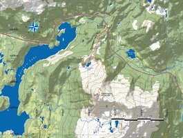
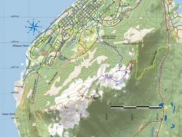
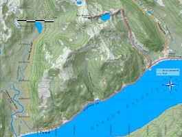
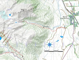
These are
letter-sized trail maps I have made of a few trails in
the Bulkley Valley (and beyond). You are welcome to
download, print and use them. Each includes a trail
description. Some were originally published in Northword
Magazine.
Note:
this page of maps is no longer being updated.
Instead, you
can browse a more up-to-date list through my interactive
map.
|
 |
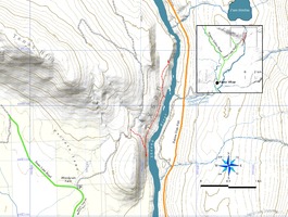
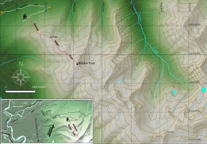
Ptarmigan
Mountain (2018)
|
 |
Mount
Hays (2017)
|
 |
Skip
Mountain (2017)
|
 |
Station
Creek (2017)
|
 |
Xsan
(2017)
|
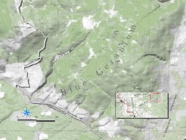 |
Blue
Geranium (2017)
|
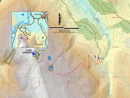 |
Story
Lookout (2016)
|
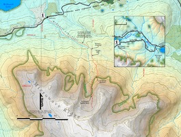 |
McDonell
Lake Trail (2016)
|
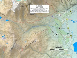 |
Opal
Ridge Trail (2016)
|
 |
Suskwa
River Wire Bridge (2016)
|
 |
Silverking
Basin Winter (2015)
|
 |
Hankin
Lookout (2015)
|
 |
Seaton
Ridge Trail (2015)
|
 |
Moonlight
Mountain
(2015)
|
 |
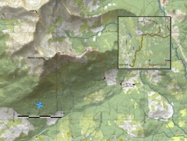
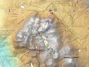
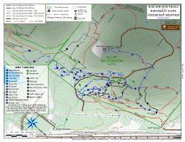
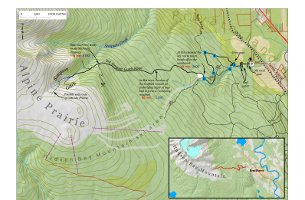
Northeast
Slope Trails (south sheet, updated spring 2015)
|
 |
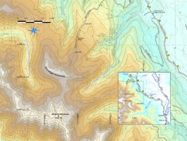
Northeast
Slope Trails (north sheet, updated spring 2015)
|
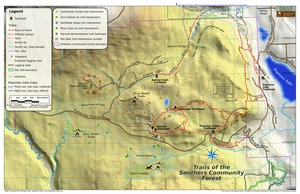 |
Trails of the Smithers Community
Forest (North) (2015)
|
 |
Tyee
Mountain Ski Trails (December 2014)
|
 |
Skilokis
Ridge (August 2014)
|
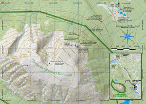 |
Nadina
Mountain (June 2014)
|
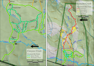 |
Canyon
Creek Ski Trails (Dec 2013)
|
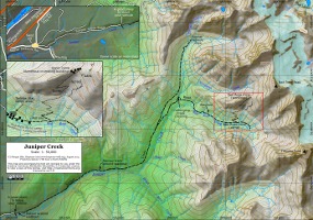 |
Juniper
Creek
and the Red Rose Mine |
 |
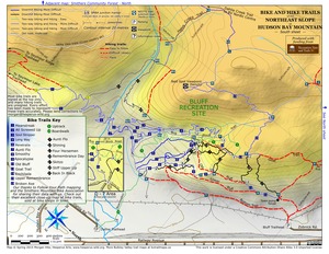
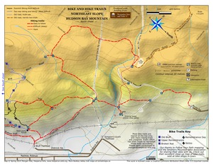
Northeast
Slope
Trails (two pages, updated Spring 2013) |
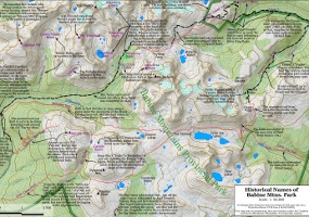 |
Historical
Names
of Babine Mountains Park |
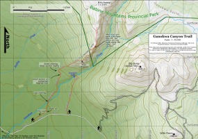 |
Ganokwa
Canyon
|
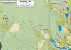 |
Barrett
Hat |
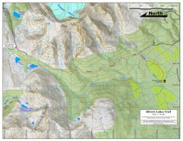 |
Silvern
Lakes
|
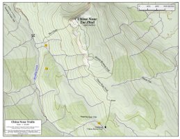 |
China
Nose |
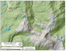 |
Robinson
Ridge
(Kitimat) |
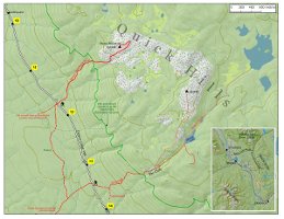 |
Moose
Mountain/Quick
Hills |
|
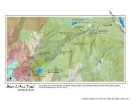
Blue Lake Trail
|
|
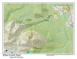
Elliot Creek Trail
|
|
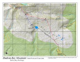
Hudson
Bay Mountain South Peak
|
|
Old
Simpson
Gulch Road
|
|
|

