 |
|
Burnie
Glacier Chalet Map
|
 |
|
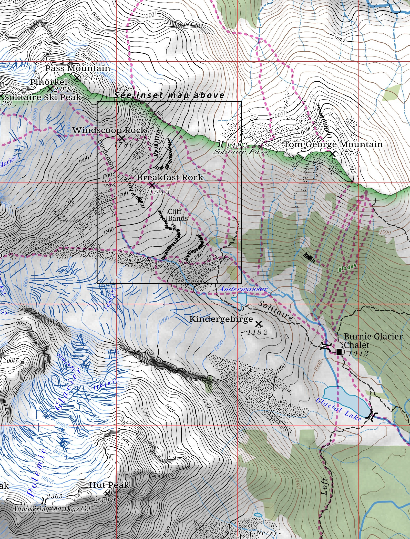
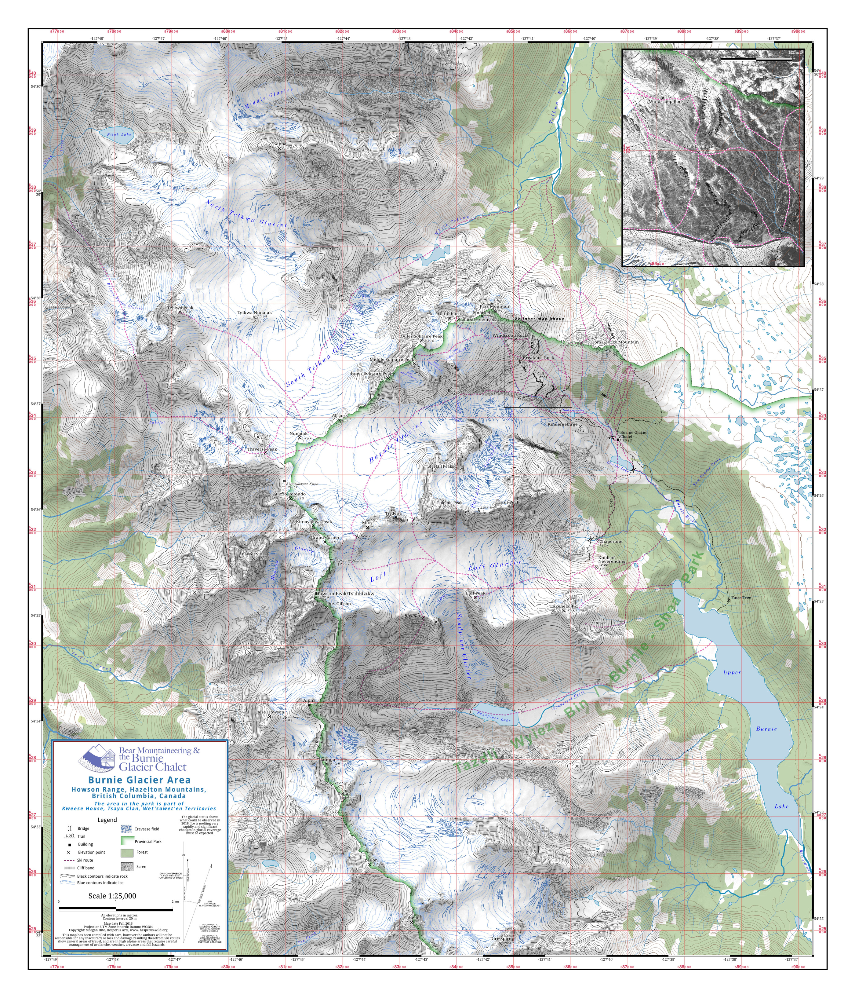
This
is a backcountry ski guide's map, to be used in route-finding
with
clients from the Burnie
Glacier Chalet. It shows the
central section of the
Howson Range of northern British Columbia; the chalet itself
is
reached by helicopter. Shaded relief
and contours were generated from
SRTM elevation data; specific details of topography were
tweaked
based on the testimony of guides. Overall style
is based on that of
the German Alpenvereinskarte.
Scree, rock and glacial extents were digitized from recent
aerial
photography.
The base map was made in QGIS.
Shaded relief was done in Blender,
based on SRTM data. Labels and explanatory notes were
added in Inkscape.
Projection is UTM Zone 9N (NAD83).
|