 |
 |
 |
|
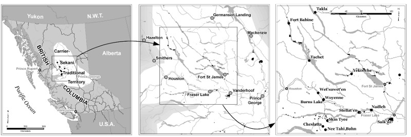
The requirement for this map was a black and white (greyscale) image that would fit into a journal article (Annals of the American Association of Geographers), and show the location of thirteen specific First Nations communities. It had to work for an international audience who could be expected to know where BC was. White is the foreground colour in both images, with background in 30% and 50% greys. First Nations communities are labelled in a black serif font, whereas other communities fade into the background with grey labels and a sans-serif font. The same font ties these to the three cities on the overview map. Rivers, lakes and highways are the landmarks by which one locates oneself in these maps. Originally published in: de Leeuw, S., S. Maurice, T. Holyk, M. Greenwood and W. Adam. (2012). With Reserves: The Geographies of Colonialism and First Nations Health in Northern-Interior British Columbia. The Annals of the American Association of Geographers. Special edition on health. 1-8. Also published in: Pawlovich J, Dalaire M. Extending the Reach of Medical Care for Remote First Nations Communities: Beyond Technology. Univ British Columbia Med J. 2014. March 1; 5(2): 9-11 |