 |
 |
| Ive just finished a
map for a book that had no map: Mountains
of
Heaven: Travels in the Tian Shan, 1913. This version of
the
Charles Howard-Burys journals from his travels in what are today
eastern Kazakhstan and the adjacent region of China, was published
in
1990 and although its out of print, its generally available in
the
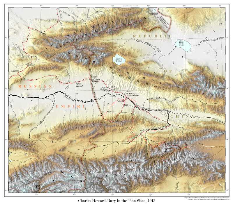
used book market. What I set out to do here was to resolve all the geographic references in the text. That is, youre reading along, and he mentions the Yulduz plains or the village of Karachekinskaia, and you dont know where that is. The various maps, atlases and website you can check dont have it. So the book needs a supporting map. Pretty simple. But it evolved into something else. Initially I planned a 24?x24? sheet of paper, a size typical of folded maps that used to be glued inside the back covers of books. It would contain three maps. There would be a 1:1 million map detailing the central portion of his journey, the area where he spends the most time and mentions the most local details. There would be a 1:3 million map showing how he got from Semipalatinsk to Jarkent, the ten-day journey along Russian post roads for whose specific route he gives intriguingly few clues. Last, there would be a map at 1:7 million showing his exit route from Central Asia, from Jarkent to Tashkent, and then on by rail to the Caspian Sea. Then things happened which illustrate some general hazards about mapping for old books. The first map became the main project, and eventually pushed both other maps off the sheet. Its what you see above. There were simply too many details to squeeze it in at a smaller scale onto part of the sheet. I let go of the idea that all the mapping one would need could fit into 24?x24?. I began building a hillshade of the area in Blender, and figured out an hypsographic colouring scheme inspired by an old Soviet topographic map of the area (?-44-?): low elevations are white, and then rise through oranges and brown to white summits. At the same time, as I tried to figure out just where Howard-Bury had gone, I found myself buried in old maps, wikipedia articles, and all sorts of other documents such as you get when you search on obscure terms like Kuitun River. I was reading maps in Russian and putting German websites through Google Translate. With each Aha! answer to a question, I felt more convinced that these puzzles for the map had come to represent a series of puzzles would make good stories. At this point the map became a poster, the bottom half of which contained explanations of stuff. Heres the poster: |
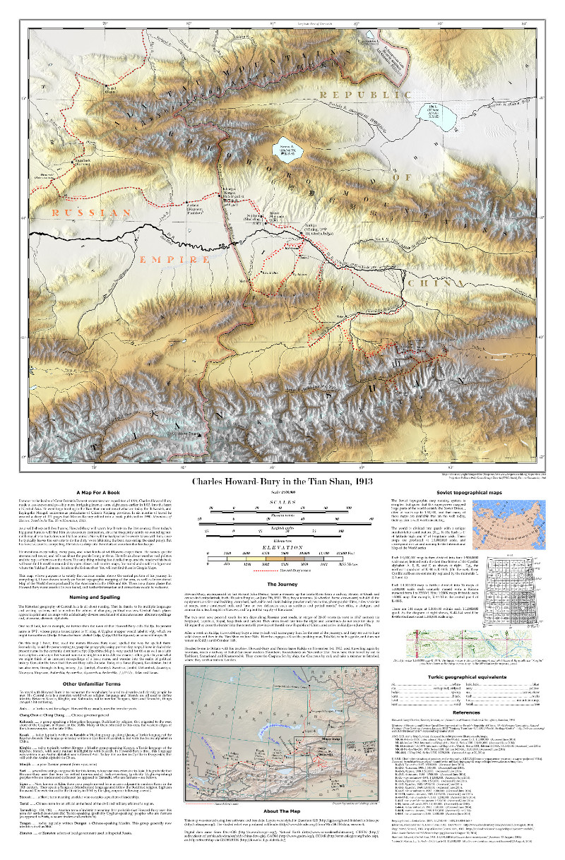 |
| The sections in the bottom half cover the
reason for the map, the plethora of alternate place names in
Central
Asia, a glossary of obscure terms Howard-Bury uses, an
explanation of
the Soviet topographic mapping system, some Turkic geographical
equivalents, and a list of references. It is, in short, a brief
tour of
all the places I had to go to produce the map. |