 |
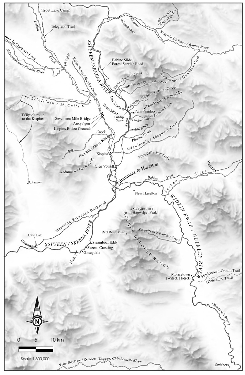 |
In 2016, Creekstone Press will be publishing Neil Sterritt's history of Hazelton and Gitanmaax, Mapping My Way Home. I was asked to do eleven maps for the book, and what an interesting collection of maps it was! As in the example above, many places in the traditional territory of the Gitxsan people have mutiple names. Sometimes the "official" (meaning gazetted) name is just a mangled version of the Gitxsan name (such as the Xsigwinya'a / Shegunia River). Other times there is yet another name based on a translation of the Gitxsan name (Xsim Haytsxw / Zymoetz River / Copper River). There were many sources for these maps, but one that really stood out was the set of maps Lou Skoda prepared for the Delgamuukw case. The eleven maps varied in scale from 1:8,500 (downtown Hazelton as it appeared in 1948) to 1:100,000,000 (the entire globe -- this one is shown below) -- and there were other maps at all sorts of scales in between. Organizing data was a project in itself, and data came from sources at many different scales. Every place mentioned in the text needed to be on a map, and in order to keep the maps uncluttered I made data layers that contained only the places mentioned in the text. It was a real privilege working with Neil and learning the details of Gitxsan geography through him. For many of these maps I used shaded relief generated in Blender, but I wanted to mask out relief details in valley bottoms, where most of the feature names would be. Using QGIS, I did this by placing the DEM (from which the shaded relief had been generated) over the shaded relief with a blend mode of Screen. I then styled the DEM as a smooth transition between solid black at 500m (pretty much the low elevation on the map) to solid white at 2000m (near the high end). The result was a shaded relief that "sticks up out of the fog" in the valley bottoms. |
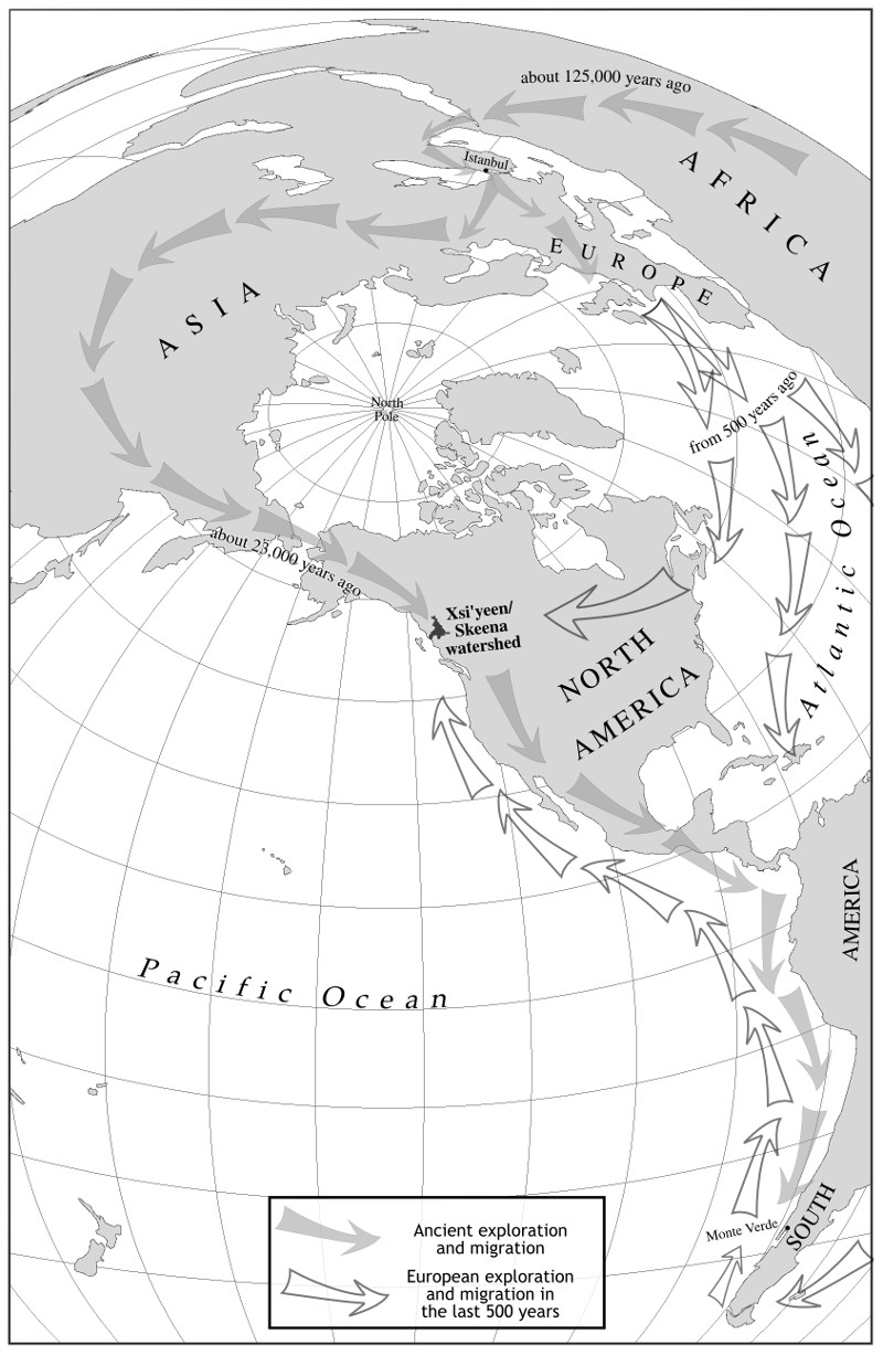 |
This is another of the maps, and this one was particularly fun in that I got to create a custom projection that would allow visibility (in a portrait format) of most of the world's land masses. The projection in this case is Lambert Azimuthal Equal-Area, centred on 30°N and 140°W. |