 |
||
 |
||
 |
||
|
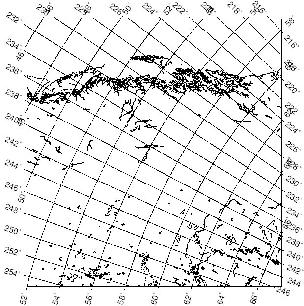
This is the Pacific coastline, from Seattle to Yakutat, shown in an Oblique Mercator Projection. The central axis of the projection was defined as a line passing through (60° N, 125° W) and (55° N, 120° W). Note that longitudes in the result are shown as positive (East) values, so that 125° W is shown as 235°. I made this map to see how the traditional north-up view of this coast affects our interpretation of it. Seen like this, the PNW coast is no longer "hanging out" over the Pacific, dropping islands down into the vast ocean. Instead, it resembles the crumbling top of a wall, fractured by frost, with gravity "pulling" the Queen Charlotte Islands and Vancouver Island back into the continent. We also see readily in this view that Great Bear Lake, Great Slave Lake and Athabaska Lake fall on a line parallel to the coast. |
||