|
|
Columbia
River Basin maps
|
|
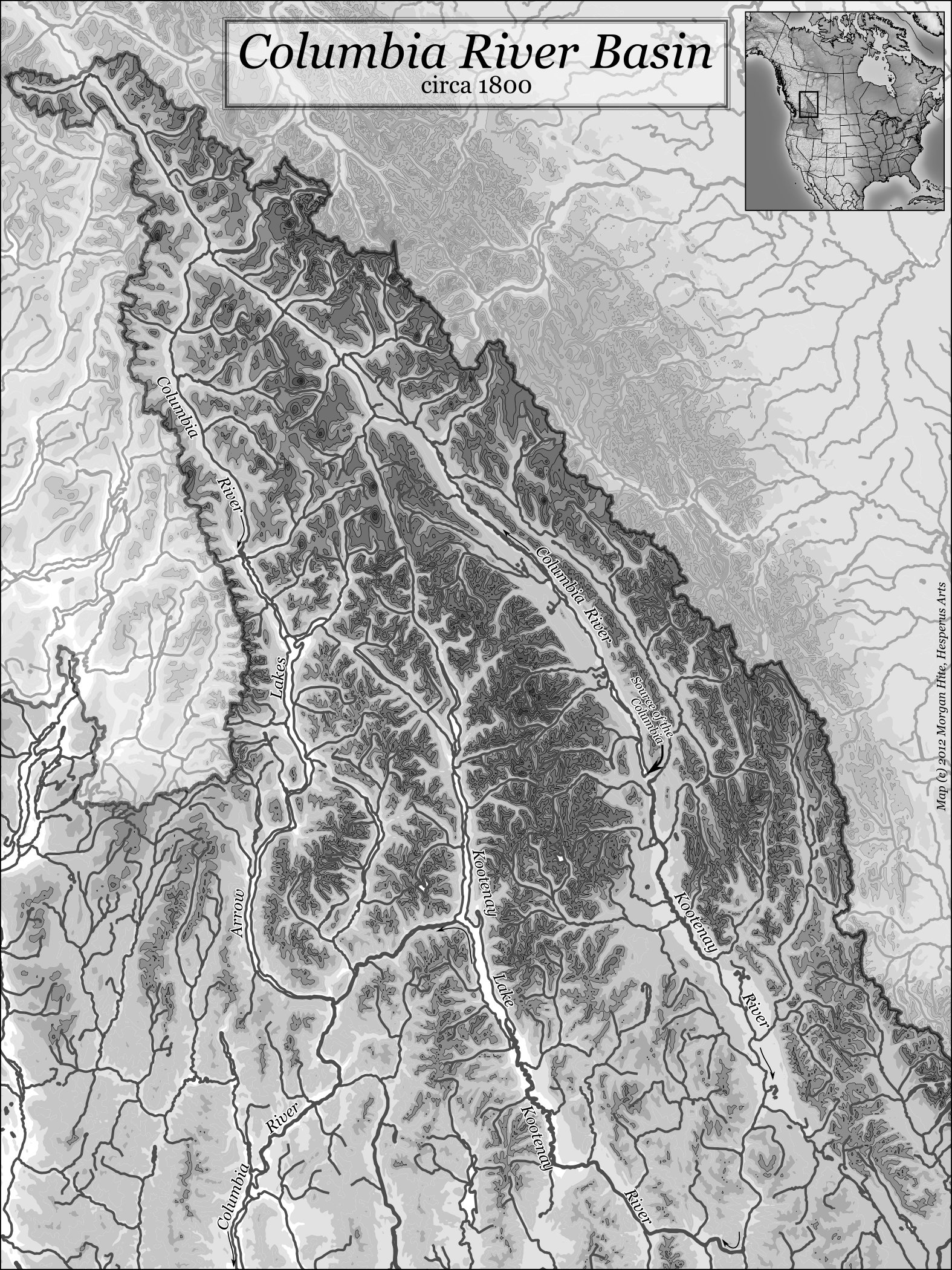
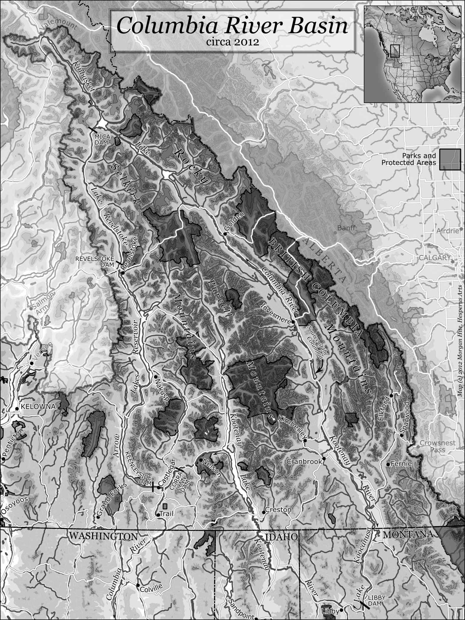
(Click on either image to see full-size.) In the fall of 2012, the Kelowna Art gallery mounted an exhibit of watercolours by John Hartman. UNBC Professor Sarah de Leeuw contributed an essay, Splittings: A Brief Geo-Scoial History of the Columbia River Basin, that appeared in a publication accomapnying the exhibit. For the essay, she asked me to make two greyscale maps of the Columbia River Basin. One map would show the area circa 1800, and the other would be contemporary. Only the later map would have the features that we have added to the geography since David Thompson first explored it in 1807 - 1811:
To fit on the page of the booklet, the scale would be 1:3,000,000. I assembled it in QGIS and added title, legend, inset map and labels in Inkscape. We defined the "Columbia River Basin" to be the upper Columbia basin, but not just the parts within Canada. The south edge of the map would be near the latitude of Sandpoint, Idaho. We also decided to include the basins of the Kootenay and Okanagan rivers, both of which join the Columbia fairly far down (from a Canadian perspective). It was in many ways an interesting challenge to find data that spanned the international boundary, or separate datasets that matched up well across the international boundary. Terrain relief came from the W140N90 tile of the USGS's gtopo30 data. I contoured it at 300m intervals with MapInfo's Vertical Mapper plugin, and displayed it with ten intervals of increasingly dark greys, from 0m to 4201m. Making the valleys light and the peaks dark made it easier to label the rivers. Rivers and lakes came from two pieces of data available at the Atlas of Canada's 1:1,000,000 framework data. For BC and the adjoining US states, I used the Pacific drainainge skeleton, which descends into the US and goes down the entire Columbia watershed. (On their website this is filed underr hydrology>analytical>drainange_network>pacific). On the Atlantic side of the divide, all the rivers visible on the map are in Alberta, so I used the cartographic data for Alberta rivers (hydrology>cartographic>ab). For the 1800 map, it was necessary to remove some man-made reservoirs from the Pacific skeleton data: Kinbasket Lake, Lake Revelstoke and Lake Koocanusa. I made a mask around the Columbia River Basin using the Atlas of Canada framework data's river basin data (Hydrology>Cartographic>Drainage Basins>River Basins) for rivers not draining into the Columbia. This was displayed as white with 50% transparency to fade features outside our area of interest. For the 2012 map, I added:
|