 |
||
 |
||
 |
||
|
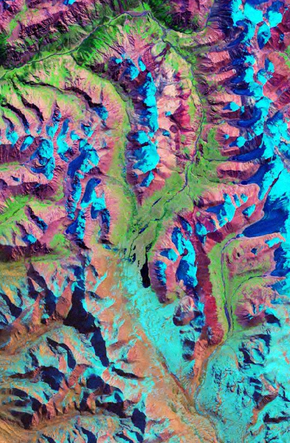
This image is a small subset of the NASA GeoCover MrSID tile "43-40," meaning UTM Zone 43, between latitudes 40° N and 45° N. The resolution of GeoCover images is 30 meters/pixel. The picture was taken in the 1990's, and has been rotated it so that North is to the left. The lake in the center is the headwaters of the Uchemchek River, which flows West (down) out of the picture. The Uchemchek eventually flows into the Naryn, a major river of Kyrgyzstan, and it in turn flows into the Syr Dar'ya. This location is at about 77° 30' E, 42° N, shown at a scale of 1:118,000. Peaks in the picture are at about 14,000' GeoCover is a short-wavelength infrared (SWIR) composite of Landsat 5 images. Landsat band 2 is displayed in blue, band 4 is displayed in green and band 7 (or 5) is displayed in red. For a nice explanation of Landsat images and bands, visit NASA's GeoCover tutorial. |
||