 |
|
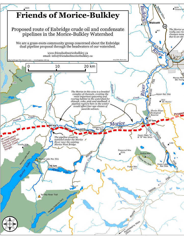
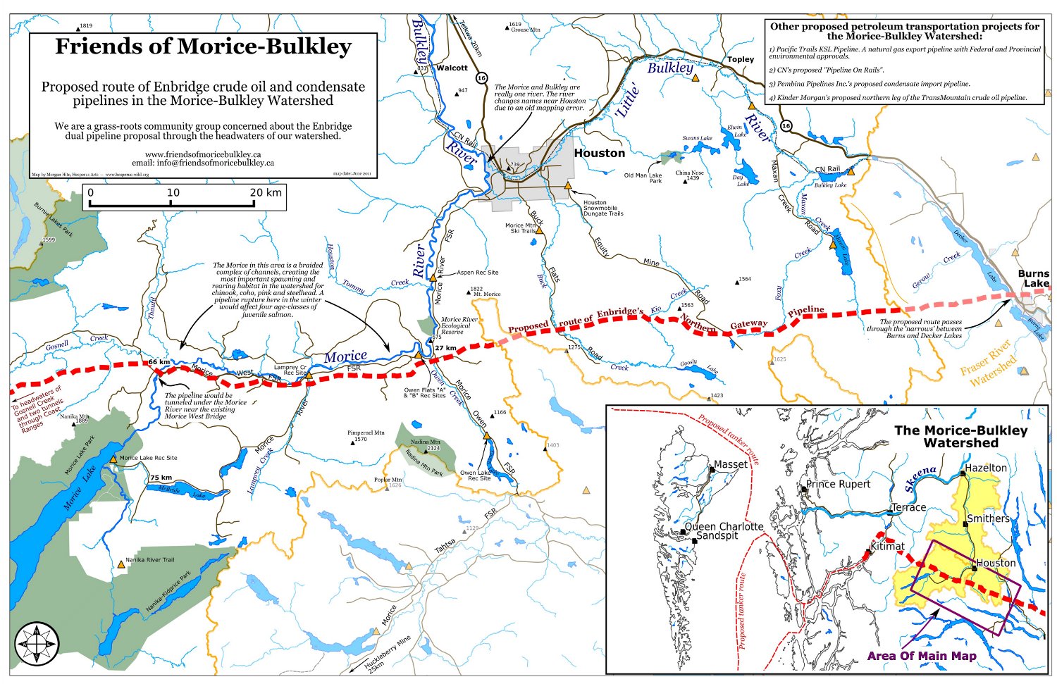
Northern Gateway Mapping
|
 |
|
The original inspiration for this map was one of the old
Morice Forest District Recreation maps, which, at 1:250,000,
show only the roads, rivers and recreations sites -- no
topography. The Friends
of Morice Bulkley asked me to make a custom version that
could be used to talk to anglers about threats from the
proposed Enbridge Northern Gateway pipeline. I used data from BC's Freshwater Stream Network and
Freshwater Lakes Atlas (available from BC's Land
and Resource Data Warehouse) for the water. Roads and
elevation points came from NTDB
data, plus a few selected Forest Service Roads picked from the
Forest Tenure Road Section Lines (LRDW). Projection is UTM Zone 9N (NAD83).
|